Low, Slow and Don’t Know (Apr 2010) by Brian Hargrave
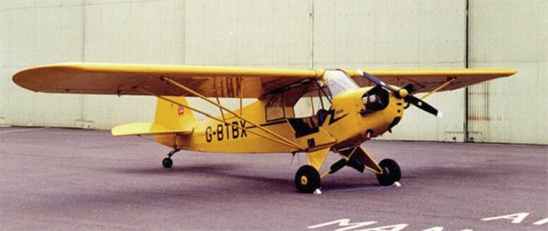
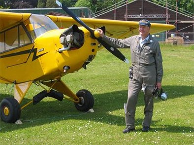
After a lunch on 2nd April last year (2009) I grabbed my flying kit, drove over to Henlow, pulled the group's Piper Cub out of the hangar, checked it out and went flying. Although the weather wasn't perhaps the best, those of you who know me won't think it unusual, so why all the fuss?
Well, earlier I was looking through my Pilot's Log Books and noticed the entry right at the bottom of the very first page which said, "2 Apr 1959, Auster Aiglet, G-AMZT, Cranfield, Local, 10 mins, FIRST SOLO," So it was the 50th anniversary of my first solo, the day when Bert Russell got out of the aircraft saying, "Now go and do one on your own," slammed the cabin door leaving me sitting amongst all those knobs, levers, handles and things, and walked away! Since then I have had a few interesting experiences, like flying an Aeronca Champ across America from coast to coast, and various other episodes perhaps best not put into print. One of the most notable was perhaps in millennium year, a while before I joined the AEG.
The Piper Rag (the Vintage Piper Aircraft Club's magazine) announced the first fly-in of 2000 to Old Buckenham on 30 April which would make a nice interesting trip from Henlow with both Cambridge and the Lakenheath group of USAF airfields on a direct track and Duxford holding an air display on the same day. As Sonia generally finds the Cub too small, smelly, noisy and bumpy (ie everything that makes it such fun to fly!) for her taste, I was somewhat surprised when she volunteered to come. "You meet such interesting people at a fly-in, and I like chatting with them," she explained.
The Piper Rag (the Vintage Piper Aircraft Club's magazine) announced the first fly-in of 2000 to Old Buckenham on 30 April which would make a nice interesting trip from Henlow with both Cambridge and the Lakenheath group of USAF airfields on a direct track and Duxford holding an air display on the same day. As Sonia generally finds the Cub too small, smelly, noisy and bumpy (ie everything that makes it such fun to fly!) for her taste, I was somewhat surprised when she volunteered to come. "You meet such interesting people at a fly-in, and I like chatting with them," she explained.
The tide had gone out at Henlow after the wettest April for donkey's years and Saturday evening was lovely with the TV weather girl promising even better to come, so I phoned Old Buck to confirm their local procedures. They also told me Snetterton was an easy-to-find reporting point on the way in, so I drew in a track on my half-million (a scale of about 8 miles to the inch) Aviation Chart easterly via the disused Bassingbourn airfield and the A14 junction at south-east Bury St Edmunds, then northerly to Old Buckenham. Bassingbourn to Bury St Eds would slot us nicely between Duxford and Cambridge and well clear of Lakenheath.
Sunday morning was bright and clear so I tuned into the Luton ATIS (pronounced Ay-tis, the Automatic Terminal Information Service which continuously broadcasts information about the airfield such as runway in use, altimeter settings, weather, etc.) It was reporting a wind of 2 knots and CAVOK (pronounced Cav-Oh-Kay, meaning Ceiling and Visibility OK or no cloud below 5000 feet and at least 10 kilometres visibility, ie excellent flying conditions), so I contributed to the Met Office profits by dialling up Airmet Southern Region on their premium-rate fax weather service - now available online following objections that it was flight safety information that should be free of charge.
Their Area Forecast in teleprinter code groups (such as "ISOL RASH" for isolated rain showers), valid 0500 to 1300 GMT (1400 BST), translated into generally 20km visibility with 1 to 4 octas (eighths) cloud cover at 3000ft, and east of Norwich generally 15km vis, with 3 to 6 octas at 3000ft with perhaps viz down to 8km in "ISOL RASH" with 6 octas of stratocumulus cloud at 2500 ft. So with nothing worse than 8km viz and 2500ft ceiling I selected 2500ft for the flight out, noting that we might have to drop down to 2000ft near Old Buck if I encountered an "ISOL RASH." Airmet forecast a wind of 100 degrees (easterly) at quite a strong 15kt at 1000 to 3000ft, which puzzled me in view of the Luton ATIS, but as this was the best guess available for wind at 2500ft, I set that in my trusty hand-operated (don't trust this newfangled electronic stuff!) swinging arm and circular slide rule navigation computer, worked out courses, ground speeds, times, etc, and entered the resultant numbers in my kneepad flight log.
At Henlow another member of the group had already flown and refuelled the Cub for us. The windsock hung limply down the pole but he told me there was quite a lot of wind higher up, 15-20kt at 2000ft, so perhaps Airmet were right after all.
With Sonia tied into the Cub's front seat (the Cub was designed in the 1930s and built in 1941 when the pilot had to occupy the rear seat to get the centre of gravity right), the paperwork, walk-round and checks all complete we were soon airborne and approaching Bassingbourn at 2500ft as planned - but what were these tiny globules like quicksilver running across the windscreen? Straight ahead cloud, rain and viz well below forecast - an "ISOL RASH" already that pushed us down to 2000ft.
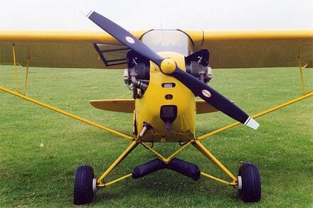
The Cub demonstrated its traditional way of clearing the screen as the rain globules ran across to the right in the propeller slipstream, through the gap where the door closes, and discharged themselves over the front seat occupant! A short burst of carb heat restored a slight fall in engine rpm and confirmed carb icing conditions. Carb heat (short for carburettor heat) is used to clear ice from the carburettor air intake that can otherwise cause engine failure. It is necessary because the air-cooled engine has no water jacket to keep the carburettor warm, and it works by diverting intake air through an exhaust gas heat exchanger. However, this also reduces engine power and increases fuel consumption, so carb heat is selected only when necessary.
In response to my enquiry, Sonia said she was happy to continue as there should only be isolated showers so I called Duxford Information. The nice lady checked the local TAFs (Terminal Airfield Forecasts) and confirmed weather much as expected, told me they had a rain shower going through but that it was clear beyond it, and there was none of their high-power machinery hurtling round the sky at present. I set course for Bury St Eds and a short time later we were cruising along in fine conditions with Fowlmere, Duxford and Cambridge all easily visible around us. When we were east of the A11 I thanked the Duxford lady and told her my next call would be to Lakenheath Approach.
Newmarket racecourse with the scalloped roof of the new grandstand was clearly visible to the north of track, but ahead was another rain shower pushing us down even lower this time to 1800 then 1500 and eventually to 1300ft to stay clear of cloud. I called Lakenheath earlier than intended and a very reassuring American voice confirmed radar contact and that our current track was "good for Bury St Edmonds." He enquired about our fuel state (one hour plus) and confirmed Honington airfield was inactive. More carb heat and some minutes later our "ISOL RASH" was proving quite extensive so I fished out the quarter-mil (aviation chart showing about twice as much detail as the half-mil), but as the countryside was rather featureless, it wasn't much help. However, Bury St Edmonds with its sugar factory soon came into sight and brought with it improving viz although cloud still kept us down at 1300ft.
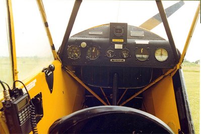
We skirted round the south-east of Bury St Eds as we were too low to over-fly our chosen turning point and set a north-easterly course on the final leg to Old Buckenham. Honington's big runway stood out well beyond the port wing tip but then another big "ISOL RASH" reduced viz again as we crossed the Thetford to Diss road with an estimated nine miles to run. I asked Sonia to "Sit up straight, please," and concentrated on maintaining the correct compass heading, working the carb heat, and looking for Snetterton and the railway line to appear from port. (The the front seat passenger is between the pilot and the instrument panel, so when they look to one side the pilot has to look past the other ear to see the compass, and if they're looking all around he can spend a lot of time dodging from side to side without ever seeing it !
Then I saw the awaited double-track railway below us - but it was on the wrong side and almost parallel to track. We'd obviously crossed over where it bent north without spotting it and so I looked back along the line to check, but no bend, no Snetterton, and where was the town of Attleborough? Also what was that airfield to the west of the railway with all the sailplanes (high-performance gliders) parked on it? My watch said we ought to be over Old Buck by now and the only gliding site west of the railway was Watton - but its railway was disused. To add to our troubles, the viz was getting even worse so I called my American guide again and asked him about an airfield with two long runways and lots of sailplanes. He didn't have the necessary local knowledge but another pilot on the frequency said he thought we were, "Probably over Tibenham."
Tibenham! I'd got the wrong railway line and we were only five miles from our destination! But as I selected carb heat for the umpteenth time and turned north-west, why couldn't I see Old Buck through the grot? Was it really Tibenham? My American friend who had twice asked if I was qualified to fly by instruments (negative and the Cub had no blind-flying instruments anyway) now called to say radar coverage in our area was limited to 3000ft minimum and, with no squawk (ie no radar transponder which boosts a received radar signal and codes it to identify the aircraft, termed "squawking"), he had lost us. He suggested calling Distress & Diversion (the people who monitor the emergency frequencies and give assistance) on 121.5Mz, but at that moment I saw the vague outline of an airfield and runway where I expected Old Buck to be and responded appropriately. As I headed in that direction, it dissolved again in a quirk of the light leaving me feeling foolish as I cancelled the sighting and confirmed the change to D & D.
For the first time in over 40 years flying, I dialled up the international distress frequency of 121.5Mz and thought about what to say.
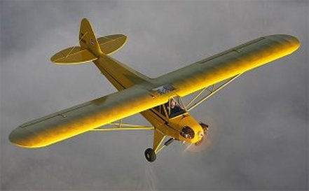
Basically I had my wife on board, couldn't recognize anything, wasn't even totally sure it was Tibenham we had seen and was down at 1300ft in poor visibility, but on the credit side we did have 45 minutes fuel in the tank. There could be no messing about whilst our credit burned, so I made it a Pan call (Mayday is better known from TV and films to indicate imminent danger to life, but "Pan Pan Pan" at the beginning of a radio message indicates that it is urgent but not life threatening), passed our details and reported lost, believed to be in vicinity of Tibenham. The Distress & Diversion controller came back instantly with his very deliberate transmissions always with our full call-sign, asked our heading and requested a turn onto a heading of 050 degrees for identification. "Golf - Bravo - Tango - Bravo – X-Ray - Your - Turn - Is - Observed!" Norwich Radar had us 15 miles south-west, pretty well just where I thought we were, and turned us left onto 360 degrees and there was Old Buck. Before I could report "Field in sight," the D & D controller told me where to look, then passed me the airfield details and frequency. I fumbled the buttons punching 124.4Mz into the radio and but a few minutes later we were on the ground refuelling.
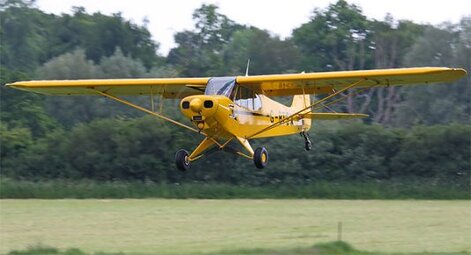
They had gone to a lot of trouble at Old Buck to make us welcome, mowing a special taxiway and parking area for Vintage Piper Aircraft Club use, and as we got out we were thanked warmly for coming!! We booked in and Sonia and I both elected to have a large mug of coffee and the Sunday Roast whilst I did the soul searching. (The roast was excellent and very good value for money, so if you're in the area on a Sunday and want a good meal, it's a good excuse to call in.)
How had I gone so wrong? I looked at my flight log and it became clearer. At the planned 2500ft, with a good imagination and only one round of toast for breakfast our 65 horsepower Cub cruises at about 70mph true airspeed, but down at 1300ft where the air is denser it is slower and with all that carb heat slowing us even more we should have been late at Bury St Eds. In fact we were quite early but I hadn't noticed just how early. That forecast easterly wind was fiction, so when I turned north and laid off 14 degrees of non-existent drift (the angle that the aircraft is blown off course in a crosswind which has to be compensated by turning the nose into wind) on the leg to Old Buck, we were actually pointing at Tibenham - and the rest, as they say, is history.
I talked to other pilots who had flown into Old Buck, in fact I couldn't stop talking once it was all over, and without exception they all told me I did the right thing calling D & D early. Several of them told me about a pilot who got lost over the sea, delayed his call and drowned when only one minute more fuel would have got him onto the beach. I still had the Airmet forecast with me, but Tony Whitlock (VPAC Chairman) who came in by road told me how he'd listened to a beautiful forecast on car radio just audible above the sound of the torrential rain and the slap of the windscreen wipers, and later one of the instructors said he hadn't been able to see the runway from the downwind leg of the airfield traffic pattern! The Met Office seemed to have got it badly wrong and we arrived when the clag at Old Buck was at its worst, so it wasn't really my fault - or wasn't I being honest with myself and had I allowed "press-on-itis" (the tendency of humans under stress to continue with their planned course of action even when it is obviously going badly wrong) to take over?
I dug out the fuel bill. They had topped up to the brim and put in 31 litres, so with a tank capacity of 45 litres there were 14 litres left after we had landed, or at 20 litres/hour, an honest 40 minutes fuel - a little more than I had expected. I asked Sonia but she said that after I had reported 1 hour's fuel near Bury St Eds, she had been concerned about finding Old Buck but not frightened as there were lots of airfields about and she knew the Cub "could land in any farmer's field." I use the loose leaf Pooley's Guide (the standard reference for aviation information, airfield data, procedures, regulations, etc, that is updated at regular intervals) because I can put the pages in my kneepad and had airfield charts for Old Buck, Cambridge, Duxford, Honington plus others with me so a number of options had been open. My intention had been to stay well clear of Tibenham and its glider-launching cables, but with hindsight it would have been wise to have had their details too.
When the weather wasn't quite as forecast I had checked with Duxford, and it really had improved east of them and again east of Bury St Eds. Had I missed the early arrival at Bury because I'd become preoccupied with carb heat? Perhaps, but getting it wrong the other way round and having the engine fail due to icing could literally have killed us both, and I'd called D & D early instead of blundering about and getting even more lost. Radio failure? Well, without being able to call D & D it would certainly have been a landing at the unidentified gliding base, but if I hadn't been able to talk to Duxford and Lakenheath earlier I would have turned back anyway.
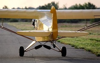
We were the last VPAC aircraft away that afternoon, having waited until it was looking brighter as promised by the Norwich TAF (Terminal Airfield Forecast), and had an uneventful flight back home. At Henlow they told us that with such a good forecast, they had been "horrified" by the "absolute grot" that had rolled in and stopped all flying for a while. I didn't express surprise - but I did later wonder what we might have run into if I had actually turned back! It had been an interesting day which I have resolved to put down to experience and learn from my mistakes. A few days later details were beginning to fade and now I can't even remember if I thanked the Lakenheath and D & D controllers who served us so well, but if you ever read this, "Thanks a lot, chaps!"
By the way, Sonia bought me a hand-held GPS for my Birthday-Anniversary-Christmas present that year. It works a bit like a SatNav but I still navigate by dead reckoning and only use it to check for deviation from planned track and other useful things like ground speed or time to next waypoint. Don't want it to do the SatNav equivalent of sending me via France or directing me over a cliff - as I said, I just don't trust this newfangled electronic stuff !
